How to find your campsite
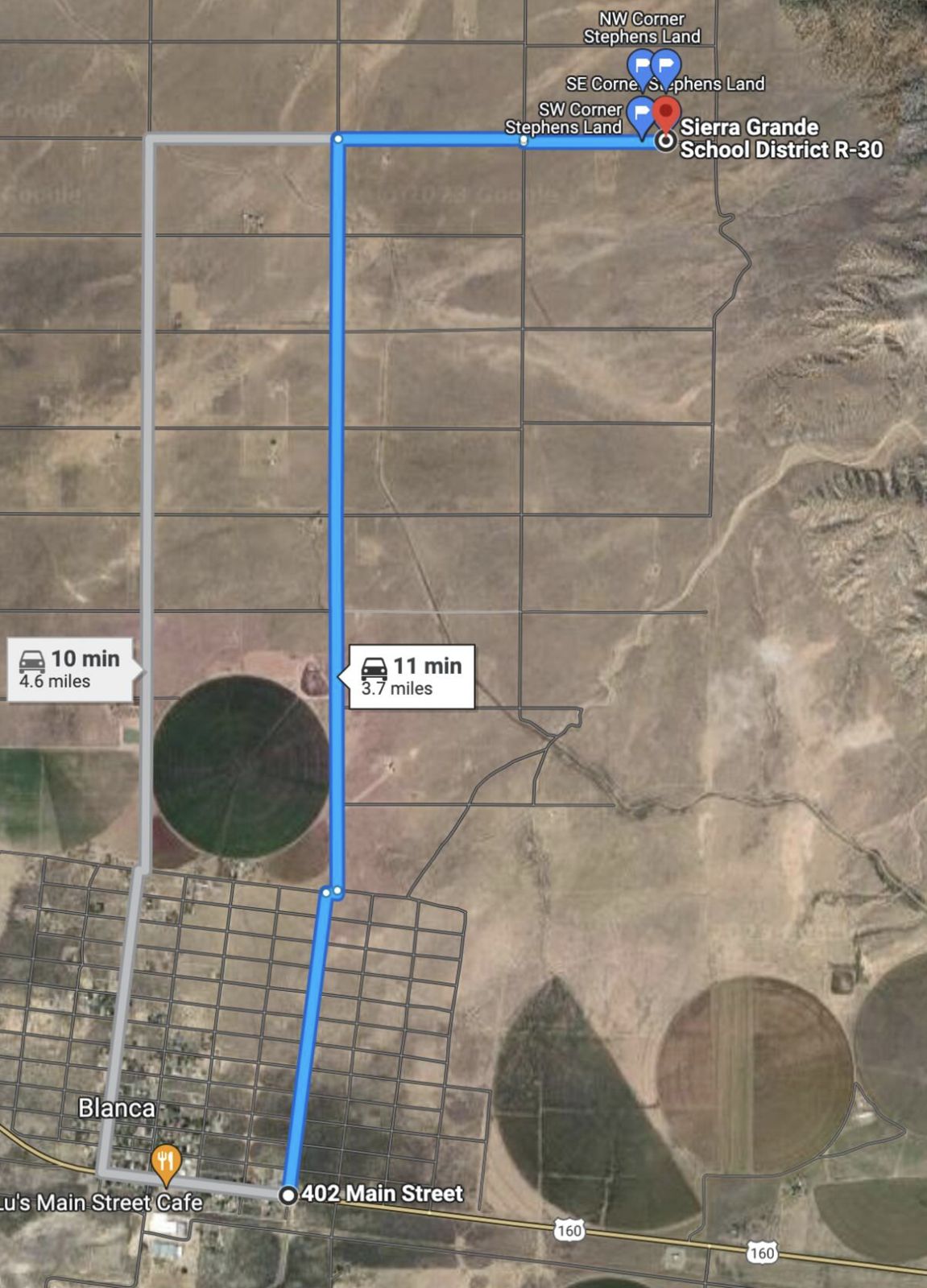
Our land has no street address, so phone maps won't take you all the way in. Use the pin below to get close, then follow the photos turn by turn.
Cell signal is spotty out here
Download these directions to your phone before you leave Blanca. The PDF has every photo and turn, and opens without signal.
iPhone: tap the PDF, then Share → Save to Files or Books. Android: it saves to your Downloads.
Find us
402 Main Street in Blanca. About 11 minutes and 3.7 miles to the campsite.
Online version with tap-to-copy pins: blancacampsite.cpsdesign.net
The What3words app is free for iPhone and Android. Our property only has a county parcel number, not a Google address, so the pin and these photos are the reliable way in.
The short version
- From Main Street in Blanca, drive north on Oak Ave.
- Turn right (east) on 8th Street. The only 8th St sign is on the left side of Oak.
- Head east past the old camper (not ours), staying on its back right side to get around the washout.
- At the large logs, turn right, then left back onto 8th Street.
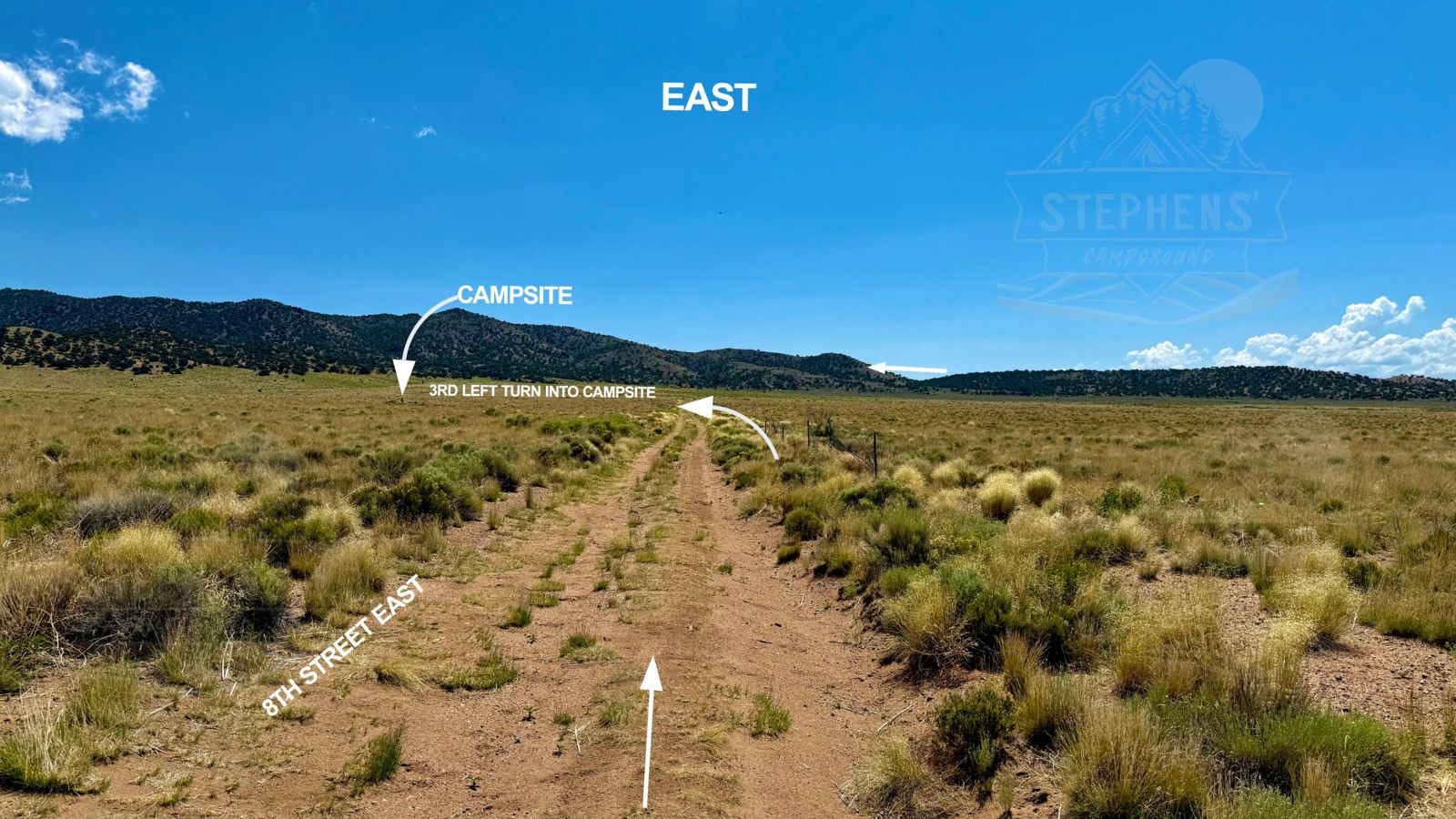
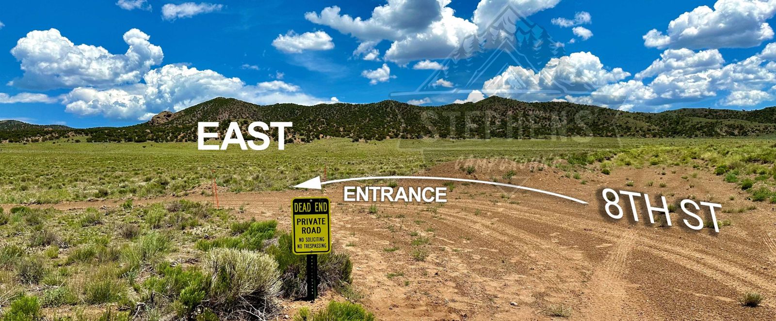
- Take the third left into the campsite, at the yellow Dead End / Private Road sign.
Turn by turn
-
Start in Blanca and head north on Oak Ave
From 402 Main Street, follow the blue route north up Oak Ave. It's about 11 minutes total to the campsite.
-
Drive north on Oak toward the big peaks
You'll be heading straight at Blanca Peak, Little Bear and Mount Lindsey. Watch for 8th Street on your right.
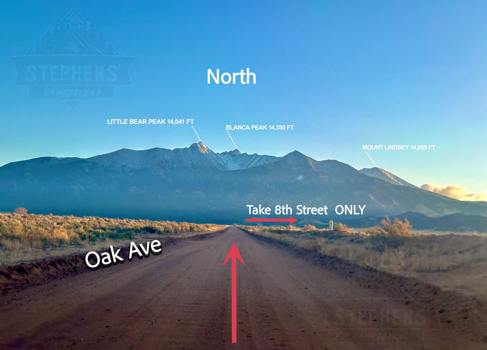
Take 8th Street only. Other side roads won't get you there.
-
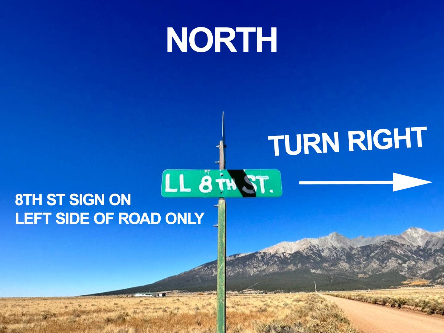
Spot the 8th St sign on your left
The street isn't marked well. The only sign is on the left side of Oak, across from the road you'll turn onto.
-
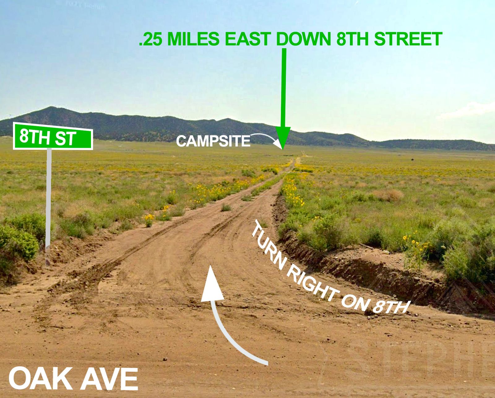
Turn right onto 8th Street, heading east
The campsite is about a quarter mile east down 8th. (We added the sign to this photo to show the turn. The real one is on the other side of Oak.)
-
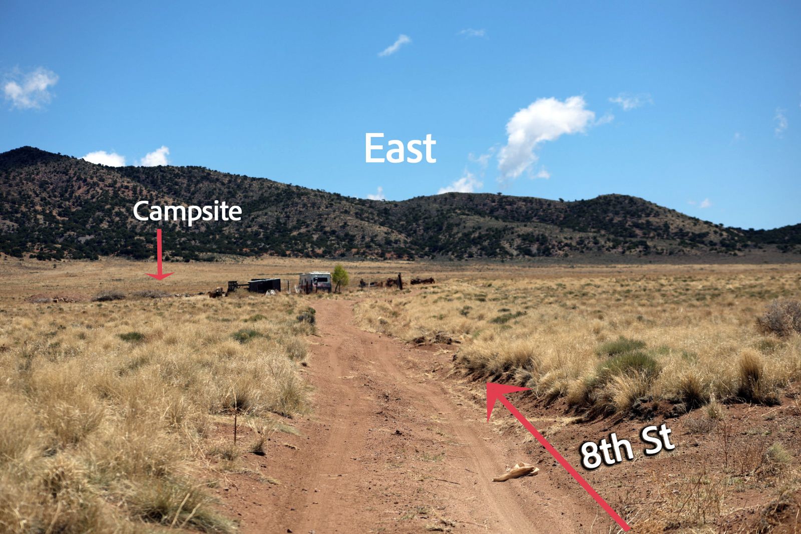
Drive east toward the old camper
You'll see an old camper and some junk ahead. It's not ours. The campsite is beyond it.
-
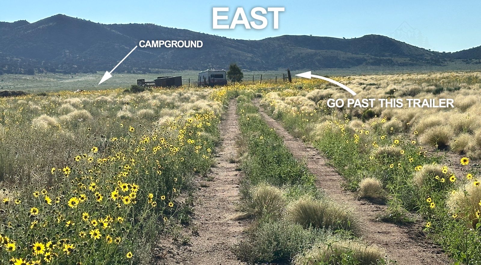
Keep going past the trailer
Stay on the two-track. Go past the trailer; the campground is off to the left.
-
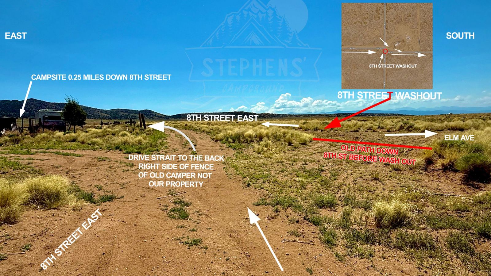
Go around the washout
8th Street is washed out here, so the old straight path doesn't work. Drive straight to the back right side of the old camper's fence, then keep heading east.
-
Right at the large logs, then left back onto 8th
The logs are on a neighbor's land. Turn right in front of them, then left to rejoin 8th Street heading east.
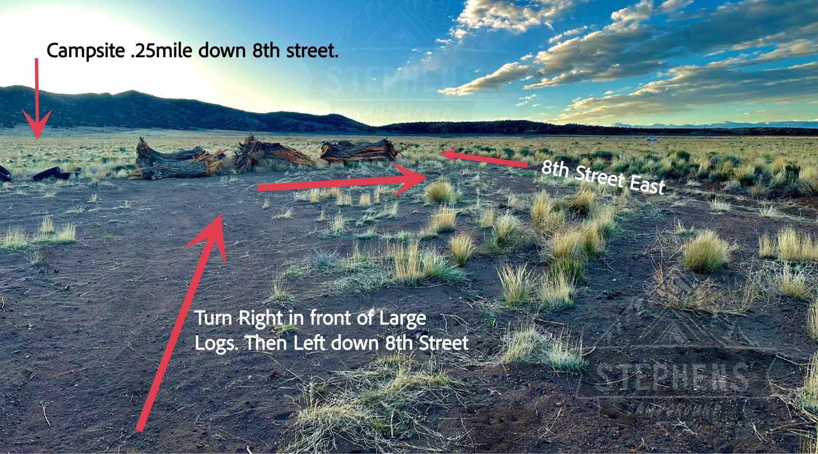
Please stay on the road here. This short stretch runs right along a private property line. The owner kindly lets us use it to get around the washout, so please be respectful. Thank you!
-
Watch for the third left
Continue east on 8th. The campsite is the third left turn. You're about 2 minutes away.
-
Turn left at the yellow sign
The entrance is marked with a yellow Dead End / Private Road sign. Turn left here. You've made it.
-
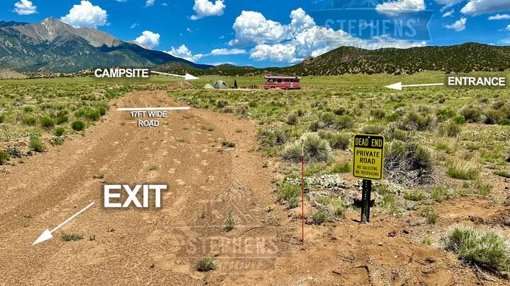
Drive in to the campsite
The road in is about 17 feet wide. The fire pit is toward the back. Use the same road to exit.
Pack in, pack out
This is a primitive site. There's no water and no restroom on site.
- Bring your own water.
- Bring a portable toilet, or an RV or camper with one built in.
- Take all trash and belongings with you when you leave.
The site is very private. We own the land around it.
Firewood & charcoal
Please bring your own. The closest source is about 15 minutes away:
High Altitude Convenience Gas Station
316 Miranda Ave, Suite B
Fort Garland, CO 81133
Firewood is usually in stock. Charcoal varies.
Fire safety
The area is very dry, and grass and brush catch easily.
- Never leave a fire unattended.
- Don't burn when it's windy.
- Keep water, a shovel, or another way to put it out nearby.
- Put the fire completely out before you leave or go to sleep.
Things to do nearby
- Great Sand Dunes National Park, plus sandboard rentals and hiking
- Smith Reservoir State Wildlife Area, about 15 minutes away
- Rattlesnake Bridge, a historic 1910 railroad trestle over Trinchera Creek
- UFO Watchtower near Hooper
Ask us for more recommendations anytime.